This map is provided by Wikipedia.
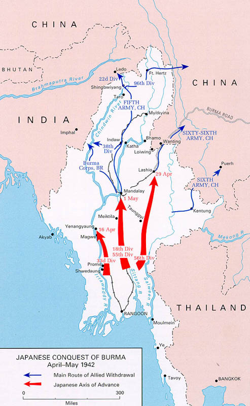
In December 1941 the Japanese began their first attacks against the Burma Army. They quickly lost control of Rangoon and the Burma Road to China. By mid January 1942 they occupied Victoria Point, which was at the southern end of Burma and provided them their first airfield in Burma (Victoria Point is not included in above map).
On 19th January 1942 Tavoy fell, leaving the garrison of Mergui isolated, which then had to be withdrawn by sea. The Japanese now had control of 3 airfields inside Burma. The fourth airfield was at Moulmein.
The RAF was very weak in Burma with only 16 fighter aircraft with the 67 Squadron, supported by one squadron of American Volunteers
It became clear by February1942 that the British were not going to stop the Japanese invasion of Burma. Between March and May a retreat was under way, including the remnants of the Chinese Army.
It was vital to halt or slow the Japanese invasion until May when the monsoon season arrived and it was thought by many, this would effectively slow the Japanese.
Burma was vital to the Allies. It provided the only viable route through to China in which the US could provide valuable supplies to China to fight the Japanese. It was essential China continue fighting so Japanese forces were split and fighting on two fronts. If China should fall, then Japan could free up numbers of fighting soldiers to send elsewhere throughout Asia.
On 14th May ‘A’ Force made up of 3,000 POWs embarked at Singapore on two ships sailing first to Victoria Point, Mergui and Tavoy. Their first work was repairing the airfields before heading to the northern end of Burma-Thai Railway in Burma by way of Moulmein. Thanbyuzayat Camp would become their base.
.